There are a lot of great map resources for Bangkok these days. Let’s have a look at some of the best map resources for checking out Bangkok.
Satellite imagery maps
Google Maps – The clear winner, although sometimes annoying because place names only in Thai.
Windows Live – Less resolution than Google on satellite imagery. Less place names.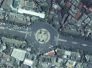
Yahoo Maps – Same satellite data as Windows Live. Terrible road view coverage.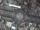
Some great Google Maps overlays:
- Wikimapia.org – A wiki for places on a map. Many places (many in Thai) are described in Bangkok, and you can add your own.
- Panoramio – Users upload photo’s and place them around Bangkok. Great to if you want to see what stuff really looks like.
- PanoramicEarth.com – Find full panoramic photos of Bangkok.
- Bangkok Recorder – An overlay of around 100 popular tourist spots, restaurants and hotels.
Other resources
Thaiways – Thaiways publishes some good paper based maps. Some of their specialist maps include Metro & Skytrain, Sukumvit, and Rattanakosin Island.
For nightlife, check out these maps with many bars, pubs and massage:
- New Petchburi Road Massage Parlors Map
- Ratchapisek Road Massage Parlors Map
- Sukhumvit Area Map
- Soi Cowboy Area Map
If you really want to get into it, the Bangkok Metropolitan Authority Department of City Planning has some map data, but mostly in Thai.
If you are using Google Earth, you’re going to need these helpful overlays. If you are curious NASA WorldWind is a similar product (.Net required).
If you have Google Earth, check out these KMZ files:
2 responses to “Ultimate map resource guide of Bangkok”
Another good bangkok map resource website.
http://www.lost-in-bangkok.com
Another good bangkok map resource website.
http://www.bangkokroughguide.info/bangkokl/bangkokmap/bangkokmap.htm